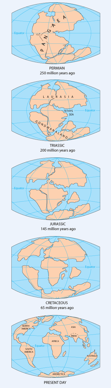
Wednesday 29 August 2012

THE RAINFOREST

The Rainforest


Global location of the tropical rainforest.


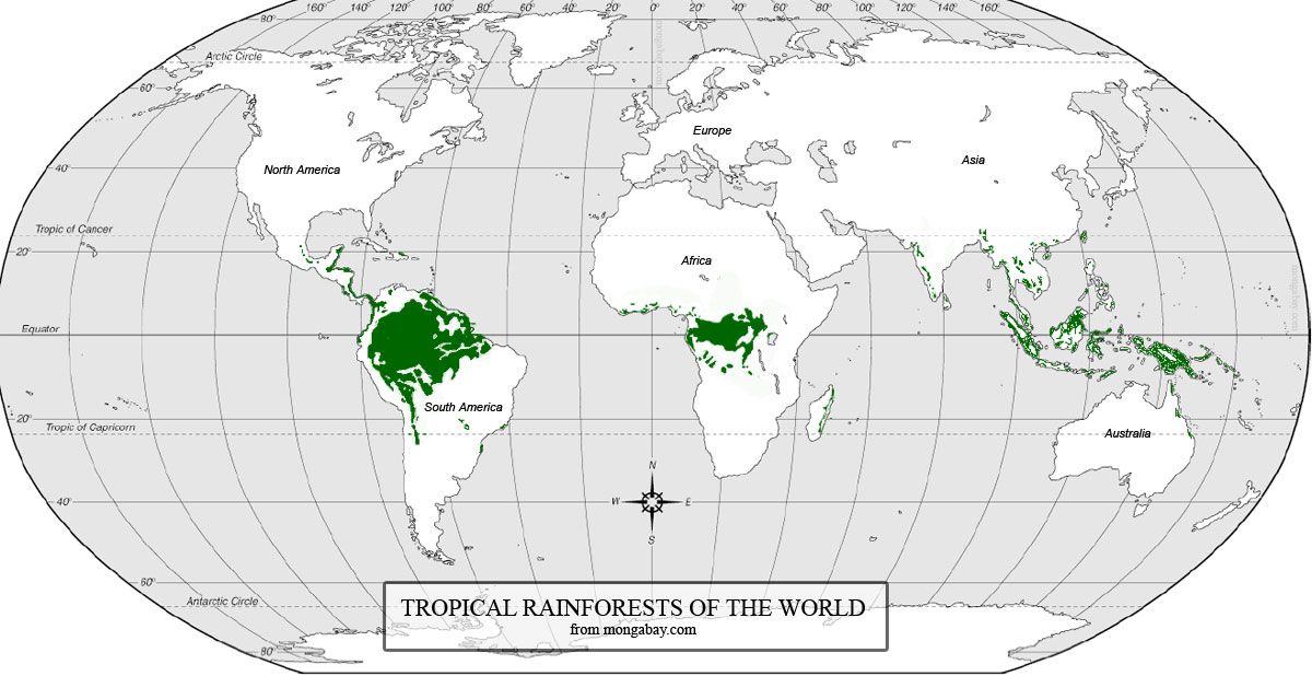
The map above could be used as a teaching tool in the introduction to the rainforest. Pupils could be asked to identify the locations of the rainforests across the world and to give possible explanations for this.

The rainforests lie in the tropical regions of the world, these areas lie between the Tropic of Capricorn and the Tropic of Cancer. The location of the rainforest on the equator is essential as the sunlight it receives is essential energy source in the process of photosynthesis. This light source is also responsible for the temperature within the rainforest throughout the year, with typical temperatures between 22-33C. This may vary with elevation where temperatures may be slightly cooler.

The layers of the Rainforest


The tropical rainforest is made up of four layers.


Emergent Layer:  The emergent layer contains giant trees which stand above the canopy layer. These trees receive the greatest amount of sunlight, low humidity and strong winds.

Canopy Layer: These trees provide a continuous canopy around 60 - 90 feet from the ground, this is partly due to the branches which are often densely covered in plants. 90% of the organisms which live in the rain forest can be found in the canopy layer.

Understory: This section of the rainforest only receives 2-15% of sunlight which fall on the canopy. It is relatively dark and home to many young trees.

Forest Floor: This layer receives less than 2% of sunlight as a result very little grows here apart from plants which have adapted to receiving very little light. Fallen leaves and vegetation cover the ground and quickly decompose.


Nutrients of the Rainforest


Most rainforest soils have poor nutrients this is due to millions of years of weathering and torrential rains which have caused the nutrients to become washed out of the soil. As a result of this most of the avaliable nutrients withing the rainforest are found in living plants and animals, when a tree dies in the rainforest organisms will absord the nutrients before they become washed away.

Human Impact on the Rainforest


It is a well known fact that large areas of the rainforest are being felled and deforestation is a major problem facing us today. 

Here are some causes of deforestation;


  • Corruption
  • Unrestricted logging 
  • Increased road networks
  • Expansion of agriculture
  • Population Growth

Impacts


When rainforests are cleared we lose much more than just trees. Biodiversity of the area is effected greatly. A number of species are dependent on the rainforest for their survival, as their habitat is located there. These species will be forced to either adapt and live in a much smaller area or to won't survive. It is estimated that one species becomes lost every half an hour as a result of deforestation of the rainforest. 

The rainforest provides food, fuels, timbre, medicines and fruits and the loss of these products through deforestation is a real issue. There is also concern for the loss of resources which are yet to be discovered especially medicines as almost a quarter of prescription medication in America is derived from tropical rainforest plants and 2000 rainforest plants have been identified by the US National Cancer Institute as having anti cancer properties.

The rainforest has a huge impact on the environment. The removal of the trees means that the soil will lose the primary source of nutrients and rain water will be able to reach the forest floor, washing out any possible nutrients. The removal of trees would increase run off which can cause flooding downstream. This occurred in Venezuela when unseasonable floods were caused by deforestation in December 1999, up to 30 000 people lost their lives and 400 000 were made homeless. 

In regards to climate it can be changed on both an local and regional scale, possibly even global depending on the size of the clearance. At a local scale the albedo of the area will be affected as the dark green of the canopy is removed and replaced by lighter shades. The solar radiation will be able to reach the surface much more easily. The soil temperature will fluctuate as a result, this could be harmful for agriculture as it increases the possibility of nutrient leaking within the soil. On a regional scale deforestation may change surface temperatures and also regional air circulation. 


Links:

http://www.mbgnet.net/sets/rforest/explore/layers.htm
http://rainforests.mongabay.com/0201.htm


PLATE BONDARIES

Divergent Plate Boundary


Diverging Plate Boundaries

At a divergent boundary a new crust will be created as two plates pull away from each. It may cause the ocean to grow wider. Iceland is a prime example of a divergent boundary as the Mid Atlantic Ridge is located here between the North American and Eurasian plates. The North American plate is moving westward and the Eurasian eastward as a result new crust is created on both sides of the boundary. The new crust creates a rift along the boundary which means that at some point in the future Iceland will seperate and the water of the Atlantic will sill the widening gap between the two plates.

Convergent Boundaries


Here crust is destroyed as on plate slides underneath another, and is then reused in the interior of the Earth as. The area where one plate goes beneath another is known as a subduction zone and at these sites mountains and volcanoes can often be found.

Oceanic-Oceanic Convergence


Oceanic-Oceanic Converging Plates


At an oceanic-oceanic convergence one plate is normally subducted under another forming a deep oceanic trench. They can also result in the formation of underwater volcanoes, the debris and lava from these volcanoes will build up over millions of years until a submarine volcano rises above sea level to become an island volcano. Theses usually create a string of volcanoes called island arcs which have been formed in the same way. 

Oceanic- Continental Convergence


Oceanic-Continental Converging Plates

When the oceanic plate pushes in to the continental plate it is subducted causing the continental plate to lift upwards and form a mountain range. The oceanic plate will sink in to the subduction trench but the deepest part of the subducting plate begins to break in to smaller pieces which become locked for long periods of time. These can then suddenly move due to the increased pressure and cause a large earthquake which may cause an uplift of the land, sometimes by as much as a few meters. 

Continental - Continental Convergence 


Continental-Continental Converging Plates

The boundary where two continents meet head on, neither will become subducted because of the light weight of the continental rock. The crust will instead be pushed upwards or sideways under the pressure. A prime example of a continental-continental convergence is the Asia and Eurasia collision 50 million years ago where the Eurasia plate crumples upwards and overrode the Indian Plate, this lead to the slow formation of the Himalayas and the Tibetan Plateau. 

Transform Fault Boundaries 


Transform boundaries occur when two plates are moving past each other horizontally, these are usually found along the bottom of the ocean floor. The San Andreas fault in California is a transform fault line which occurs on land, it connects the East Pacific Rise with the South Gorda Explorer Ridge. The fault is approximately 1, 300km long and in places it is tens of kilometers wide, the Pacific plate has been moving past the North American plate for almost 10 million years at an average rate of 5 cm/ yr.  


To teach the different types of plate tectonics I thought that it would first be useful to use a world map to locate the seven main plates which make up the crust. Then we could identify the features which occur along the plate boundaries and possibly match these to the specific types of boundaries.

EARTHQUAKES

Earthquakes


The crust of the earth is not a rigid and immobile structure. Early civilization were aware of this and constructed buildings that would withstand earthquakes, such as the Royal Palace in Crete. 

How earthquakes occur 

Earthquakes are the result of a slow build up of pressure within the crustal rocks. This pressure will build and then suddenly release which causes parts of the surfaces to experience jerking or vibrations. The point where the pressure is released is the focus, and the point on the surface which receives the worst of the seismic waves is known as the epicentre. The earthquake itself may cause a substantial amount of damage and loss of life but the secondary effects can be just as devastating but may last much longer than the primary damage such as lack of water, spread of disease and loss of homes and economy. 


Continental Drift

In 1620 Francis Bacon noted the jigsaw like link between the coasts of South America and the west coast of Africa. Later in 1912 a German meteorologist Alfred Wegener published his theory that at some point a long time ago the continents joined together in a super continent called Pangaea. This landmass later split and various continents started to from. 

pangea map

Plate Tectonics

The crust of the earth is divided in to seven layers with a number of smaller sections. These float on a semi molten mantle which move the plates by convection currents. Convection currents are a result of heat generated by the centre of the earth, the hotter semi molten lava from the core rises to the crust and then cools and returns to the core this creates the currents. There are two different types of plates, oceanic and continental. The continental crust is made up of older, lighter rock which is dominated by minerals rich in silicon and aluminium. Oceanic crust is much younger and has a denser rock type. Its dominant minerals are silicon and magnesium.  

Case Studies

MEDC: San Francisco October 1989 


At 5:04pm on October 17th 1989 an earthquake occured in San Francisco measuring 6.9 on the Richter scale. The quake only lasted 9 seconds but the quake was devastating for San Francisco. The city lies on the San Andreas fault line where two continental plates are moving past each other in opposite directions (a consrvative plate boundary). 

The effects of the earthquake;

- 67 Deaths
- 6,000 Homes damaged / destroyed
- Damage to infrastructure - electricity / gas and water mains cut
- 2000 people made homeless
- Upper deck of the Nemitz highway collapsing onto the lower deck crushing people in their cars
- A section of the San Francisco-Oakland Bay Bridge collapsing
- Fire resulting from gas explosions
- Massive economic costs ($4.4 billion)


LEDC: Kashmir 8th October 2005 


On 8 October 2005, an earthquake measuring 7.6 on the Richter scale hit the Kashmir region of Pakistan. The earthquake was the result of collision between the Indian and Eurasian plates.


Effects of the earthquake;

  • Approx. 80,000 people died - 79,000 from Pakistan, 1,400 in Kashmir, 4 in Afghanistan
  • 3.5 million left homeless
  • 380,000 were in need of emergency housing
  • 4,000 households were inaccessible by road due to landslides
  • 2.3 million people were without food for the winter
  • Disease spread, sourced from people drinking the dirty, contaminated water (this was all they had at the time by means of water)
  • homeless people died from hypothermia in the mountains (there was little to keep them warm as aid was slow to arrive)


Thursday 23 August 2012

GLACIERS

Here goes my first blog! 

I'm going to look at Glaciers, a subject that I have never covered throughout my time studying Geography.

So firstly the all important question . . . What is a Glacier?

Glaciers are made up of fallen snow which has over passed the melting of evaporation period this then becomes compressed to create a large area of thickened ice masses (the size of a glacier can vary dramatically, some as large as a football field and some being hundreads of kilometers wide), the process takes place over a number of years. The ice masses have the ability to move and currently glaciers make up almost 10% of the worlds surface, most commonly being located in the Polar regions. 


The Global location Glacier Regions

Location of Glaciers


Looking at the map above it is quite clear as to why glaciers would be located within the polar regions with their cold temperatures and abundance of water, however the location of glaciers in Chile and parts of Africa may be a surprise to some people. In these areas there are mountain summits such as Kilimanjaro where the higher up the mountain the colder the temperature which leads to the creating of glaciers. The further down the mountain you move, as temperatures rise the process of albation takes place. This is the process by which ice is lost from a glacial surface through the processes of melting, sublimation or the calving of 
icebergs. 


How Glaciers effect Land

The sheer size and weight of glaciers suggests that they will impact the landscape in some way. Glaciers are also responsible for carrying broken rock far from its area of origin, something scientists have witnessed globally. 

Glacial Erosion

Glacieated Vallys : This is where entire mountain sides are removed by glaciers often leaving steep sheer cliffs. An example is Yosemite National Park in the USA where glaciers left deep valleys. 

Fjords: "are long, narrow coastal valleys that were originally carved out by glaciers. Steep sides and rounded bottoms give them a trough-like appearance. Because of glacial erosion on the below sea level land surface, when glaciers finally disappear, sea water covers the valley floor". This type of glacial erosion is common in Norway. 


Glaciers and Climate Change

Glaciers are a key tool in understanding how the atmosphere has changed over thousands of years, particularly as the age of the ice caps can vary so much. Scientists have  taken samples from a number of different glaciers globally and have studied them to gain information about the past climate of our world. The ice caps contain important information such as trapped air bubbles which can tell scientists about different types vegetation and atmospheric conditions. Using this data scientists can map the expected temperature changes to our atmopshere based on the previous Ice Ages, however there is a problem  . . . .  .

In recent times glaciers around the world have been retreating at an alarming rate, this is mainly due to events such as the Industrial Revolution and the use of fuel such as petroleum and coal which attribute to the increase in carbon dioxide in the atmosphere and also green house gases. The glacier retreat has been so severe in some cases that glaciers have disappeared altogether. 


Links: 

As a teaching aid this video on the creation of Glaciers could be used: http://www.youtube.com/watch?v=tM3x6_vb8_s